
Keyword
Glaciers inventory
4 record(s)
Type of resources
Available actions
Topics
Keywords
Contact for the resource
Provided by
Formats
Representation types
Update frequencies
Status
Scale
-
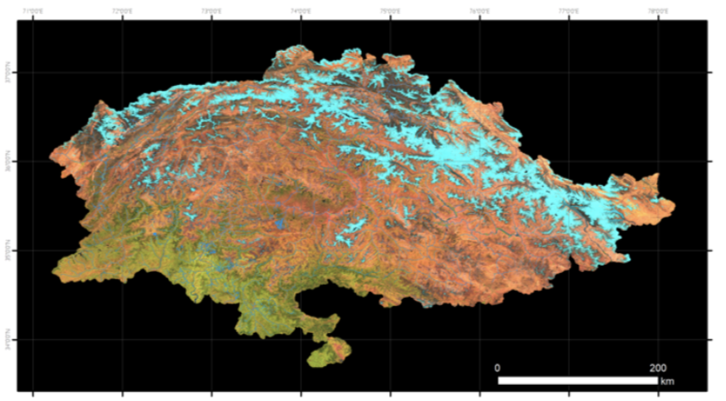
Sentinel-2 RGB composite image of the Pakistan region used in this inventory. This image is the synthesis of all the images acquired by the Sentinel-2 satellites in the period “2022-07-31" -"2022-10-01. In the Red, Green and Blue channels the SWIR, NIR and Red bands are represented. The main land cover types can be identified: in bright blue the snow, in dark blue the ice, in bright and dark tones of red the bare soils and rocks, and in green the vegetated areas.
-
One of the most important results of Glaciers & Students Project is the publication of the book that describes the activities end the methods adopted for the recognition and mapping of the 13,032 glaciers in Pakistan in the three ranges of Himalaya, Karakorum and Hindukush. The analysis of the satellite of 2022 gives a precise delineation of the surface of the glaciers and gives the possibility to verify the trend that happened in the last 30 years comparing the previous inventory with the new one. The knowledge of the places that host the glaciers of Pakistan is presented in this book with a series of maps of the 62 basins that occupy the Northern areas of Pakistan. The maps are published with scales aimed at a clear representation of the glacier distribution in each basin. To facilitate the recognition of glaciers in some wide basins, the zoom panels represented in the boxes were produced at the most suitable scale.
-
Glaciers & Students project aims at developing a consolidating program to establish monitoring of high altitude climate and assessment of glacier changes, in support of environmental monitoring and natural resources management in Pakistan Mountains, Project activities will also contribute to improve risk assessment and prevention, dealing in particular with GLOFs and hydrogeological hazard, thanks to the application of remote sensing and GIS techniques and a dedicated web information system. The project intends to actively involve Pakistan Universities and their students in the monitoring activities through a dedicated training and capacity building program in the field of glaciers monitoring activities and remote sensing analysis in order to provide the appropriate tools to ensure the pursuing of a long term research activities at the end of the project. The responsible of the funds was UNDP Pakistan. EvK2CNR Pakistan has been the reference partner of this project and the universities of Milan and Cagliari have been involved for the execution of the activities. The final products of the projects are: - the new glaciers inventory in shape format; - the text with the presentation of this new output and the single maps of each basin.
-
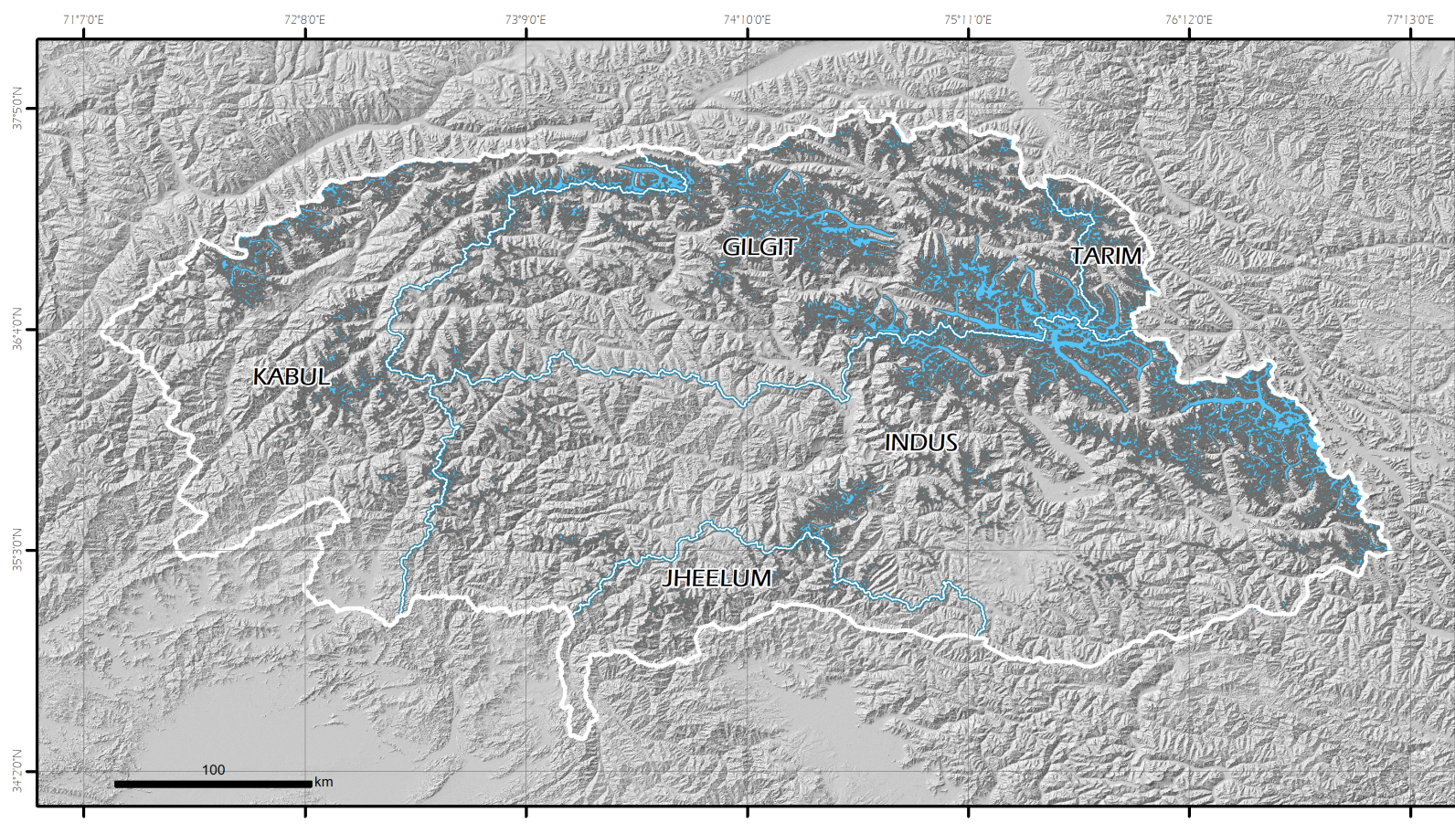
This new Pakistan glacier inventory has been extracted from optical data acquired by the European Space Agency Sentinel-2 twin satellites. This choice is dictated by the need to respond to the requirement to have homogeneous coverage of the entire territory under examination in terms of image acquisition dates, cloud cover and good spatial resolution, that allow the recognition of glaciers and their mapping. Furthermore, particular attention in the selection of the data processing and mapping methods was given for the expected prospect activity of updating the glacial perimeters and monitoring changes in the future. The methodology was based on a semi-automatic classification (segmentation) and the mapping has been implemented in a Geographic Information System (GIS) environment. In this new inventory, 13,032 glaciers covering 13,546.93 km2 have been mapped. The available inventory is the Version 1.0.