
Type
dataset
541 record(s)
Type of resources
Available actions
Topics
Keywords
Contact for the resource
Provided by
Years
Formats
Representation types
Update frequencies
Status
Scale
Resolution
-
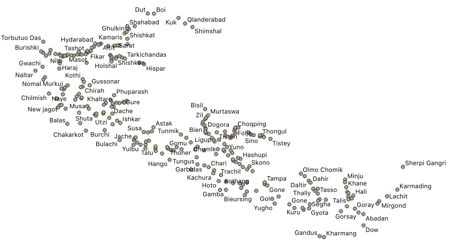
The villages small town were divided in two layers. This layers has the small settlements. Data were collected in the field and ffrom existing maps and local information.
-

-
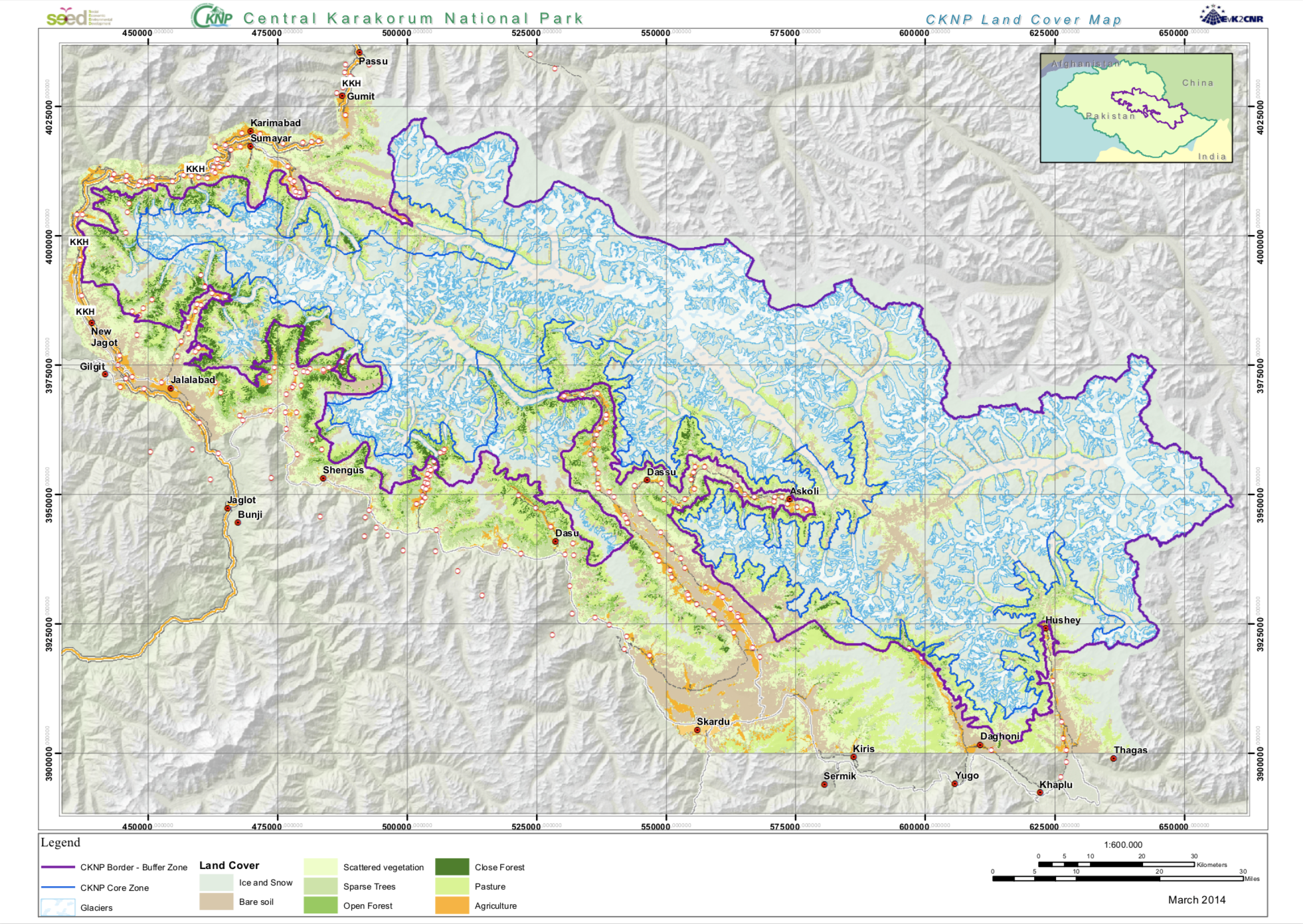
The Land cover map has been produced in the SEED project from Landsat satellite data applying a semi-authomatic classification.
-

Continuous surface ozone measurements conducted since 1996 within the Global Atmospheric Watch (GAW) programme of the World Meteorological Organization.
-

Survey 2012 Date: 01 giugno 2012 Measure System: salt tracer Q (m3/s): 31,8 q (m3/(s km2)): 0,038
-

This paper presents studies of stratospheric intrusions in the Alps and northern Apennines, their seasonal variations, and their effect on ozone concentrations. The results are based on experimental data and on simulations with a Lagrangian tracer model. The model, employing analyzed meteorological data, advects a passive stratospheric ozone tracer through the calculation of a large number of three-dimensional trajectories. In two case studies, the model is evaluated using a comprehensive set of observation data, consisting of water vapor satellite images, total column ozone measurements, ozone soundings, and measurements of ozone, beryllium 7 and meteorological parameters at three high Alpine sites and at the highest peak in the northern Apennines. During the two episodes considered, stratospheric air was detectable in the whole Alpine area with peak ozone mixing ratios in the 70–90 ppb range and even penetrated into some valleys. During one episode, stratospheric air also reached the northern Apennines, which highlights the large extension of the affected region. At the end of this episode, as shown by the model, the air was a mixture of tropospheric air with air originating from three different stratospheric intrusions. For three high Alpine sites, the frequency of stratospheric intrusions and its seasonal variation is derived using ozone, beryllium 7 and humidity measurements. The periods covered by this climatology are 1991 to 1997 for Zugspitze, and 1996 to 1998 for Jungfraujoch and Sonnblick. Another short climatology was established from a three-year (1995–1997) model simulation. Good agreement between the two approaches is found for Zugspitze and Sonnblick: the simulated ozone tracer mixing ratios are significantly higher on “intrusion days”, identified from the observations, than on “non-intrusion days”. For Jungfraujoch, the agreement is less good, which could partly be due to the coarser time resolution of the beryllium 7 measurements at this site. The absolute frequency of stratospheric air intrusions as identified from the observations depends critically on the specification of threshold values for ozone, beryllium 7 and humidity, while the relative shape of the annual cycle is rather insensitive to threshold variations. At Zugspitze and Sonnblick, it shows a maximum in October, a secondary maximum in January and February, and a deep summer minimum. For Jungfraujoch, where the frequency of intrusions is higher than at Zugspitze and Sonnblick throughout most of the year, no clear seasonal variation is found. Simulated ozone tracer mixing ratios in the Alps are found to peak in late-winter/early-spring, when ozone concentrations are at a maximum in the stratosphere, but are almost at the same level in autumn, due to somewhat higher frequency of stratospheric intrusions in that season. Similar to the observations, there is a deep minimum in summer, when the model showed practically no intrusions with a tropospheric age of less than four days.
-
The ISO19115 metadata standard is the preferred metadata standard to use. If unsure what templates to start with, use this one.
-

Visitors at high altitude are increasing in age and comorbidities, which can lead to a failure in acclimatization. We describe the development of acute mountain sickness (AMS) in a 44-year-old man with metabolic syndrome and the time- and altitude-dependent correlation between the development of AMS and blood pressure and heart rate changes. Our observations support a dominant role of endothelial dysfunction in the pathogenesis of AMS and suggest new behavioral indications.
-
The ISO19115 metadata standard is the preferred metadata standard to use. If unsure what templates to start with, use this one.
-

Measurements of cosmogenic and natural airborne radiotracers were carried out at Mt. Cimone, Italy (44 degrees 11N, 10 degrees 42E; 2165 m a.s.l.). This work concerns measurements of Be-7, Pb-210 and R-222, inorder to point out the detection and the identification of air massesof different origin reaching Mt. Cimone. Some preliminary data are presented.