
denominator
100000
27 record(s)
Type of resources
Available actions
Topics
Keywords
Contact for the resource
Provided by
Years
Formats
Representation types
Update frequencies
Status
Scale
-
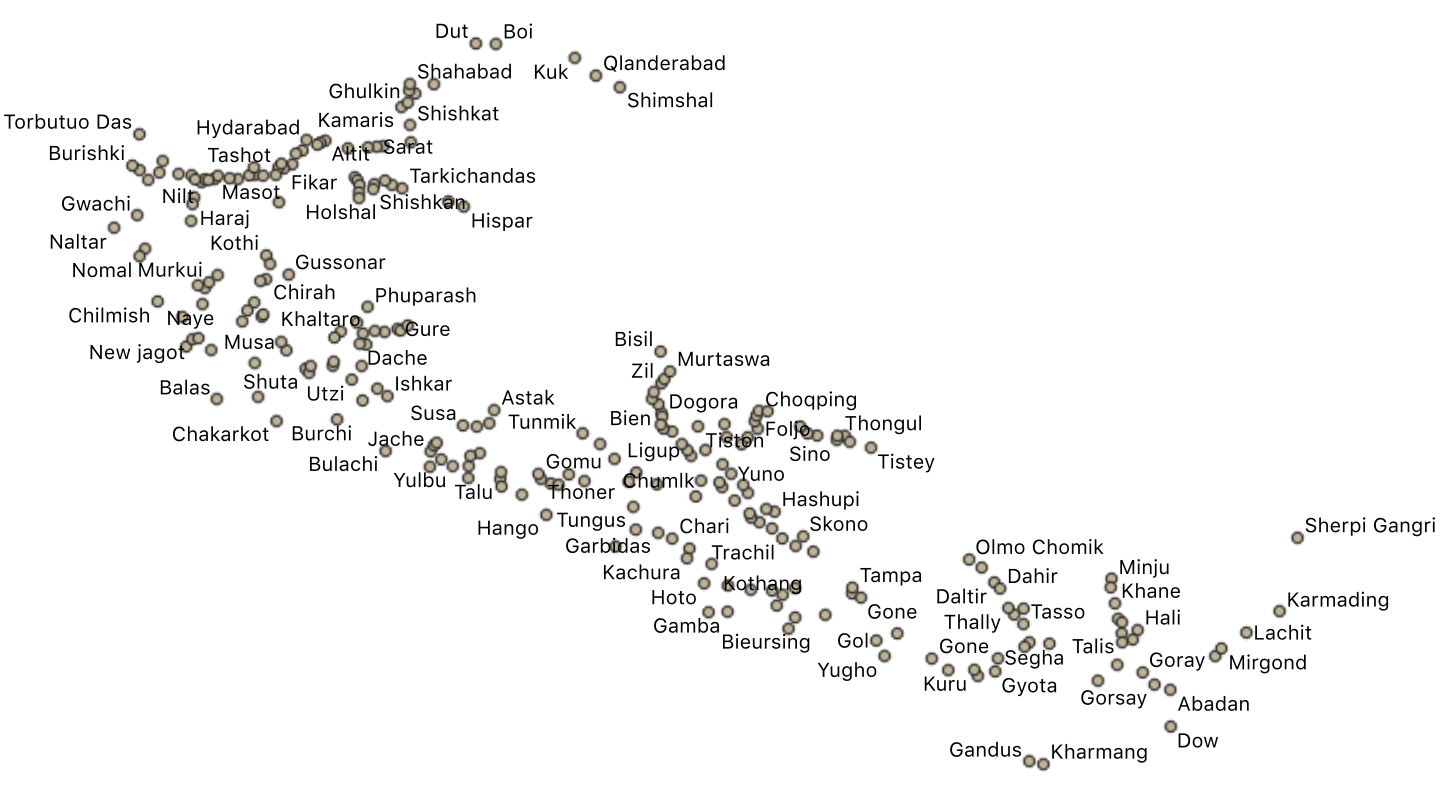
The villages small town were divided in two layers. This layers has the small settlements. Data were collected in the field and ffrom existing maps and local information.
-
Protected areas of the Central Karakorum National Park. http://www.cknp.org./cms/
-
This new Pakistan glacier inventory has been extracted from optical data acquired by the European Space Agency Sentinel-2 twin satellites. This choice is dictated by the need to respond to the requirement to have homogeneous coverage of the entire territory under examination in terms of image acquisition dates, cloud cover and good spatial resolution, that allow the recognition of glaciers and their mapping. Furthermore, particular attention in the selection of the data processing and mapping methods was given for the expected prospect activity of updating the glacial perimeters and monitoring changes in the future. The methodology was based on a semi-automatic classification (segmentation) and the mapping has been implemented in a Geographic Information System (GIS) environment. In this new inventory, 13,032 glaciers covering 13,546.93 km2 have been mapped. The available inventory is the Version 1.0.
-

A 160 m ice core was recovered in June 1996 from Eclipse Icefield (60.51 degrees N, 139.47 degrees W, 3017 m elevation). Visible stratigraphy (location and thickness of ice layers) and density measurements were made in the field, and then the core was shipped frozen to the University of New Hampshire. The core was continuously sampled in 10 cm segments, corresponding to a minimum of 12 samples per year. Above the firn-ice transition which occurs at 45 m depth, core was scraped on an acrylic lathe system under a laminar flow bench using a titanium scraper so that all surface and sub-surface contamination from the drilling process was removed. Below the firn-ice transition, samples were cut into 3 x 3 cm pieces 10 cm long and the middle of the samples melted out using a custom made melter also used to sample the GISP2 ice core. Samples were analyzed for major ions (Na+, NH4+, K+, Mg2+, Ca2+, Cl-, NO3-, SO42-) using a Dionex model 2010 ion chromatograph in a dedicated laboratory at the University of New Hampshire. The cation system used a CS12A column with CSRS-ultra suppressor in auto suppression recycle mode with 20 mM MSA eluent. The anion system used an AS11 column with an ASRS-ultra suppressor in auto suppression recycle mode with 6 mM NaOH eluent. Analytical precision was monitored by analyzing 10% of the samples in duplicate and found to be 11% for K+, 10% for NH4+, 7% for Na+, and less than 5% for all other species. Aliquots of the same samples were also analyzed for oxygen isotopes (delta 18O) at the Stable Isotope Laboratory in Copenhagen, Denmark (precision ± 0.05‰). Chronology of the Eclipse ice core is based on multi-parameter annual layer counting of seasonal oscillations in the stable isotope and major ion records (especially Na+ and NH4+). Age control on the chronology established via annual layer counting is provided by the 1963 and 1961 beta activity reference horizons and volcanic reference horizons identified by statistical analysis of the sulfate record and verified by tephrochronology. The resulting time scale indicates that the Eclipse 1996 ice core covers the period 1894 to 1996, with dating error in the core estimated to be +1 year based on the number of independently dated horizons. The chemical data presented here are at sub-annual resolution, and annually averaged. Data for the years 1894, 1995, and 1996 are incomplete and not included in the annual averages.
-

A 160 m firn and ice core was recovered from Eclipse Icefield (60.510 N, 139.470 W, 3017 m elevation) in the summer of 1996. Visible stratigraphy (location and thickness of ice layers) and density measurements were made in the field, and then the core was shipped frozen to the University of New Hampshire.
-
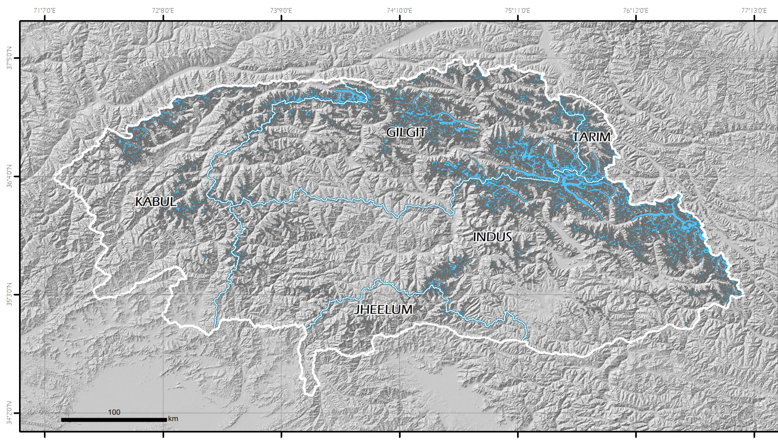
The great rivers of interest in the study of the area of the Central Karakoram National Park, including the Indus river and the Gilgit river.
-

In 1997, three ice cores were recovered from the Dasuopu glacier (28°23'N, 85°43'E) with the use of an electromechanical drill in dry holes. The first core (C1) was 159.9 m long and was drilled at 7000 m above sea level (a.s.l.) down the flow line from the top of the col, and two cores (C2 and C3), 149.2 and 167.7 m long, respectively, were drilled to bedrock 100 m apart on the col at 7200 m a.s.l. Visible stratigraphy showed no hiatus features in any of the cores. All cores were analyzed over their entire lengths for oxygen isotopic ratio (?18O ), chemical composition, and dust concentration.
-

Icecore 345 m was recovered in 2002, core was sampled continuously at high resolution for major ions and stable isotopes to establish a detailed chronology for the core. Sample resolution ranged from 6 to 15 cm for major ions and 2 to 15 cm for stable isotopes. Stringent core processing techniques were used to ensure samples were contamination-free at the ng/g level.
-
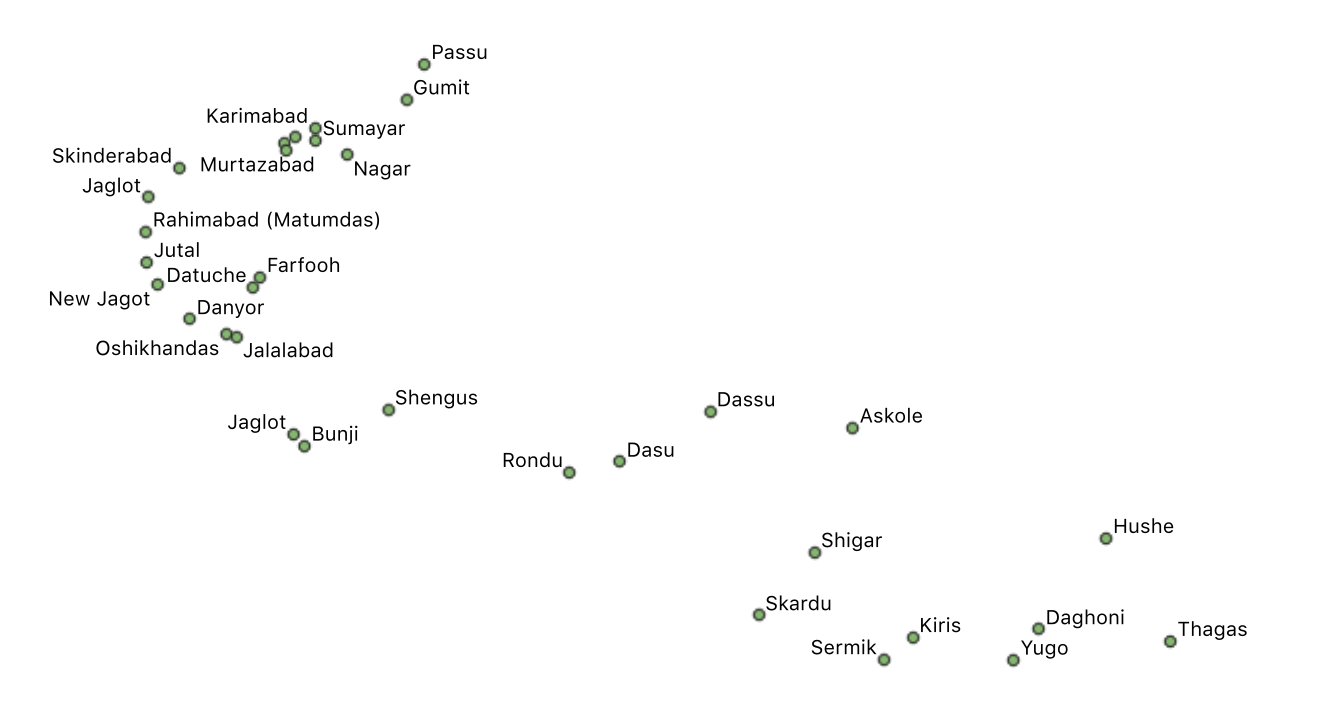
In this layer, the main villages of the CKNP are shown.
-

Two ice cores (118.4 and 214.7 m in length) were collected in 2000 from the Puruogangri ice cap in the center of the Tibetan Plateau (TP) in a joint US-Chinese collaborative project. These cores yield paleoclimatic and environmental records extending through the Middle Holocene. The high-resolution Puruogangri climate record since AD 1600 details regional temperature and moisture variability.