
Keyword
CKNP
7 record(s)
Type of resources
Available actions
Topics
Keywords
Contact for the resource
Provided by
Representation types
Update frequencies
Status
Scale
-
Elevation contours (1000 meters) of the Central Karakorum National Park.
-
Rivers of interest in the study of the Central Karakorum National Park.
-
Protected areas of the Central Karakorum National Park. http://www.cknp.org./cms/
-
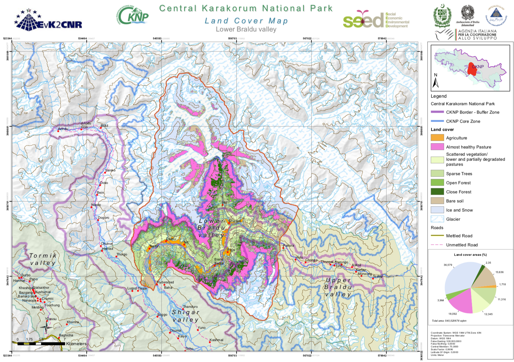
The Central Karakorum National Park (CKNP) is one of the most important national parks of Pakistan and comprises one of the largest mountain glacial systems in the world with Siachen (75 km), Baltoro (57 km) and Hispar-Biafo (122 km) glaciers originating within its boundaries. Administratively, it is situated in the Skardu and Gilgit districts of the Gilgit and Baltistan Region of Pakistan. The 72,500 km2 national park borders China, Afghanistan, and India, and represents one section of the of Hindu Kush-Karakorum-Himalaya mountain range. The area is part of the "transitional zone" between the arid Central Asia and the semi-humid subtropics of the northern South Asia. The land cover map for the CKNP has been divided into 14 subregions as follows: - Astak - Bagrot - Basha - Daghoni - Danyore - Ghulmat - Haramosh - Hopper - Lower Braldu - Nagar - Shigar - Thalay - Tormik - Upper Braldu
-
The great rivers of interest in the study of the area of the Central Karakoram National Park, including the Indus river and the Gilgit river.
-
Central Karakorum National Park, the largest protected area in Pakistan (10,000 square kilometer) is situated in the northeast of Gilgit-Baltistan. It falls into the administrative districts of Gilgit, Skardu, and Ghanche. These limits are defined within the SEED project.
-
The glaciers of Central Karakorum National Park, the world’s largest glacial area outside of the Polar Regions.