
Keyword
pakistan
2 record(s)
Type of resources
Topics
Keywords
Contact for the resource
Provided by
Representation types
Update frequencies
Status
From
1
-
2
/
2
-
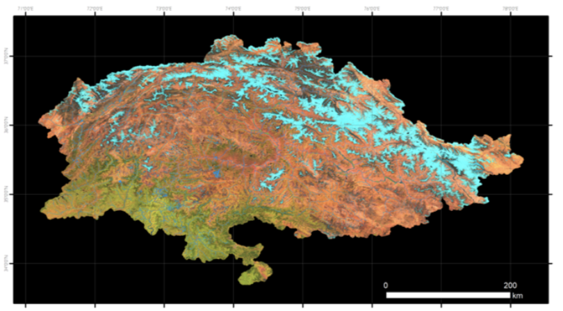
Sentinel-2 RGB composite image of the Pakistan region used in this inventory. This image is the synthesis of all the images acquired by the Sentinel-2 satellites in the period “2022-07-31" -"2022-10-01. In the Red, Green and Blue channels the SWIR, NIR and Red bands are represented. The main land cover types can be identified: in bright blue the snow, in dark blue the ice, in bright and dark tones of red the bare soils and rocks, and in green the vegetated areas.
-
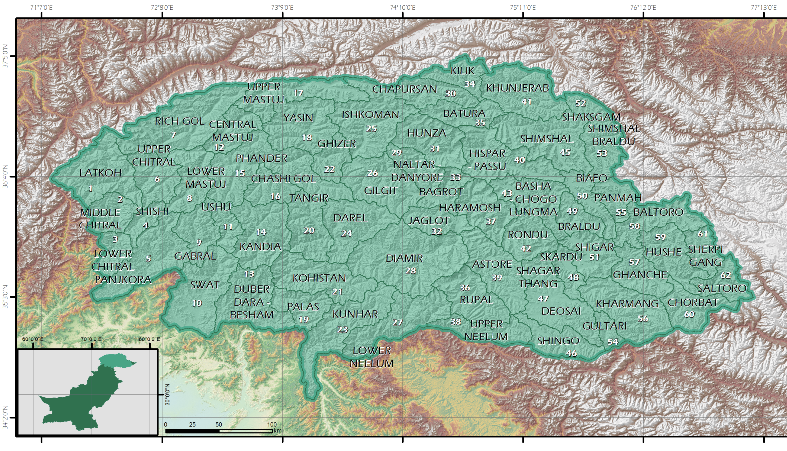
In this project, tin order to facilitate the recognition of the glaciers, the region has been divided in hydrographical basins. These basins have been extracted from the DEM ALOS AW3D30 global DEM, at 30 m spatial resolution. The region has been divided in 62 basins.