G&S - Gilgit-Baltistan Hydrographical Basins
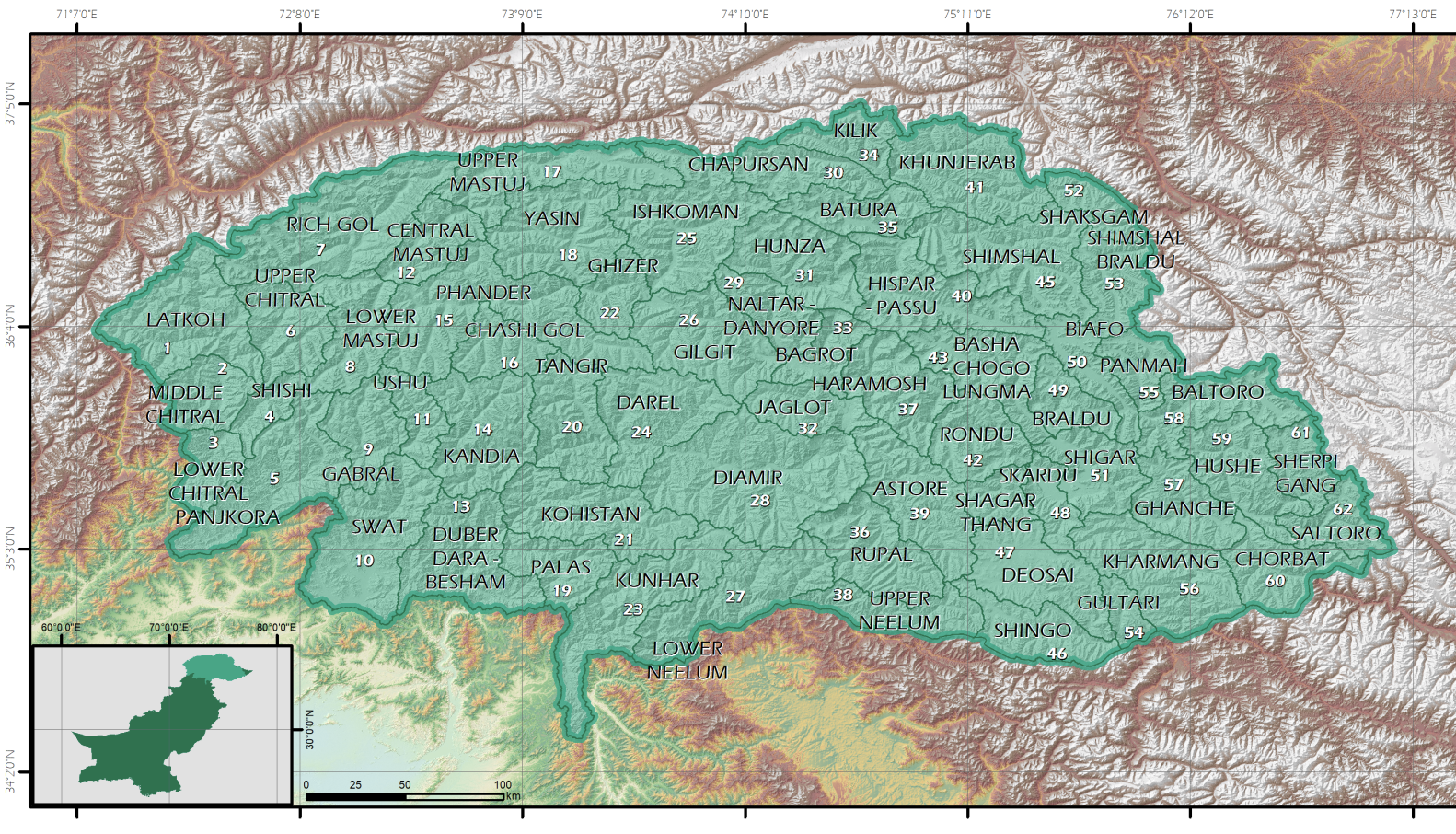
In this project, tin order to facilitate the recognition of the glaciers, the region has been divided in hydrographical basins. These basins have been extracted from the DEM ALOS AW3D30
global DEM, at 30 m spatial resolution. The region has been divided in 62 basins.
|
|
Citation proposal
(2024) . G&S - Gilgit-Baltistan Hydrographical Basins. https://geoportal.mountaingenius.org/geonetwork/srv/api/records/ecc64625-4826-4570-8e88-9ba4fcdd6147 |
- Identification
- Distribution
- Quality
- Spatial rep.
- Ref. system
- Content
- Portrayal
- Metadata
- Md. constraints
- Md. maintenance
- Schema info
Identification
Data identification
Citation
- Date ( Publication )
- 2024-04-12
- Purpose
- Status
- On going
Distributor
- Maintenance and update frequency
- As needed
- Keywords ( Theme )
-
- glaciers
- Keywords ( Place )
-
- pakistan
- Keywords ( Place )
-
- Gilgit-Baltistan
- Keywords ( Theme )
-
- Glacier inventory
- Keywords ( Theme )
-
- hydrographical basins
- Keywords ( Theme )
-
- basins
Legal constraints
- Access constraints
- Copyright
- Use constraints
- otherRestictions
- Other constraints
- Spatial representation type
- Vector
- Metadata language
- English
- Character set
- UTF8
- Topic category
-
- Boundaries
- Climatology, meteorology, atmosphere
- Environment
- Geoscientific information
- Time period
- 2022-07-012024-06-30
))
- Supplemental Information
-
You can customize the template to suit your needs.
You can add
and remove fields and fill out default information (e.g. contact
details).
Fields you can not change in the default view may be accessible in the
more
comprehensive (and more complex) advanced view. You can even use the
XML editor
to create custom structures, but they have to be validated by the
system, so
know what you do :-)
Distribution
- OnLine resource
- Gilgit-Baltistan Hydrographical Basins
Quality
Data quality
- Hierarchy level
- Dataset
- Statement
Ref. system
- Reference system identifier
- WGS 1984
Metadata
Metadata
- File identifier
- ecc64625-4826-4570-8e88-9ba4fcdd6147 XML
- Metadata language
- English
- Character set
- UTF8
- Parent identifier
- fdadcd47-ce80-4f6b-9b04-68c9f3d33bee
- Date stamp
- 2024-06-02T16:19:50
- Metadata standard name
- ISO 19115:2003/19139
- Metadata standard version
- 1.0
Point of contact
Overviews
Provided by