
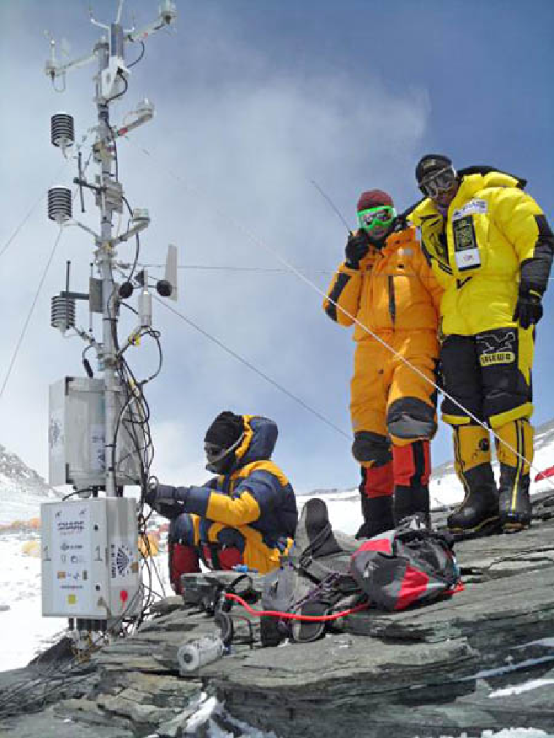
Mt. Everest, South Col (Himalaya - Nepal)
In the Khumbu Valley, located in the central part of the Himalayan range and including the area of Sagarmatha National Park, a network of 7 Automatic Weather Station (AWSs) has been installed since 1994.
These weather stations are located at different altitudes: Lukla (2,660 m a.s.l), Namche (3,570 m a.s.l), Periche (4,260 m a.s.l), Lobuche (5,050 m a.s.l) near the Pyramid Laboratory - Observatory, Kala Patthar (5,600 m a.s.l), Changri Nup Glacier (5,700 m a.s.l) and Mt. Everest - South Col (8.000 m a.s.l).
The network mainly takes measurements of 7 standards parameters: air temperature, relative humidity, atmospheric pressure, wind speed and direction, global radiation and total precipitation.
After a test period during summer 2008, the South Col AWS station has been re-installed on May 2011. The South Col station is equipped with technologically-advanced sensors for measuring temperature, humidity, wind speed and direction, atmospheric pressure and solar radiation. Support, energy and data transmission systems are optimized for functioning in adverse weather conditions. South Col AWS observations can provide useful information for investigating: (i) the variability of the subtropical jet stream analysis, (ii) the summer monsoon onset and decay, (iii) the stratospheric intrusion events, (iv) the occurrence of severe weather conditions on Mt. Everest.
Geographical coordinates:
- Latitude: 27° 58' N
- Longitude: 86° 56' E
|
|
Citation proposal
(2011) . Mt. Everest, South Col (Himalaya - Nepal). https://geoportal.mountaingenius.org/geonetwork/srv/api/records/aefba089-9967-434c-b58b-53c4b74f2a1a |
INSPIRE
Identification
- File identifier
- aefba089-9967-434c-b58b-53c4b74f2a1a XML
- Hierarchy level
- Series
Online resource
- Protocol
- OGC:WMS-1.1.1-http-get-map
- Protocol
- GLG:KML-2.0-http-get-map
- Protocol
- WWW:DOWNLOAD-1.0-http--download
Resource identifier
- Spatial representation type
- Vector
Encoding
Projection
- code
- WGS 84 (EPSG:4326)
Classification of data and services
- Topic category
-
- Climatology, meteorology, atmosphere
- Geoscientific information
- Environment
Classification of data and services
Coupled resource
Coupled resource
Classification of data and services
Coupled resource
Coupled resource
Keywords
- GEMET themes ( Theme )
-
- air , climate , natural areas, landscape, ecosystems , pollution , research
Other keywords
- Keywords ( Theme )
-
- SHARE , network, real time data , monsoon , stratospheric intrusions , subtropical jet stream , NEXTDATA
- Keywords ( Place )
-
- Nepal, Himalaya, Mt. Everest - South Col
Geographic coverage
))
Temporal reference
Temporal extent
Temporal extent
- Date ( Publication )
- 2011-04-12T19:08:00
Quality and validity
- Lineage
Conformity
Conformity
Conformity
Conformity
Conformity
Conformity
Restrictions on access and use
- Access constraints
Restrictions on access and use
Responsible organization (s)
Contact for the resource
- Organisation name
- Ev-K2-CNR
- evk2cnr@evk2cnr.org
- Organisation name
- Institute of Atmospheric Sciences and Climate (ISAC) - CNR
- p.bonasoni@isac.cnr.it
Responsible organization (s)
Contact for the resource
- Organisation name
- Ev-K2-CNR
- evk2cnr@evk2cnr.org
- Organisation name
- Institute of Atmospheric Sciences and Climate (ISAC) - CNR
- p.bonasoni@isac.cnr.it
Metadata information
Contact for the metadata
- Organisation name
- Ev-K2-CNR
- metadata@evk2cnr.org
- Date stamp
- 2025-02-10T13:25:40
- Metadata language
- eng
- Character set
- UTF8
SDS
Conformance class 1: invocable
Access Point URL
Endpoint URL
Technical specification
Conformance class 2: interoperable
Coordinate reference system
Quality of Service
Access constraints
Limitation
Use constraints
Limitation
Responsible custodian
Contact for the resource
Conformance class 3: harmonized
Overviews
Provided by
