
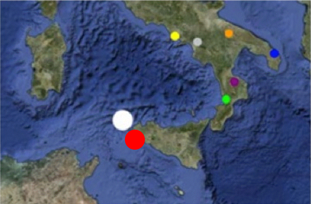
Capo Granitola (Sicilia)
Geographical Coordinates:
- Latitude: 37°34'15.42" N
- Longitude: 12°39'34.81" E
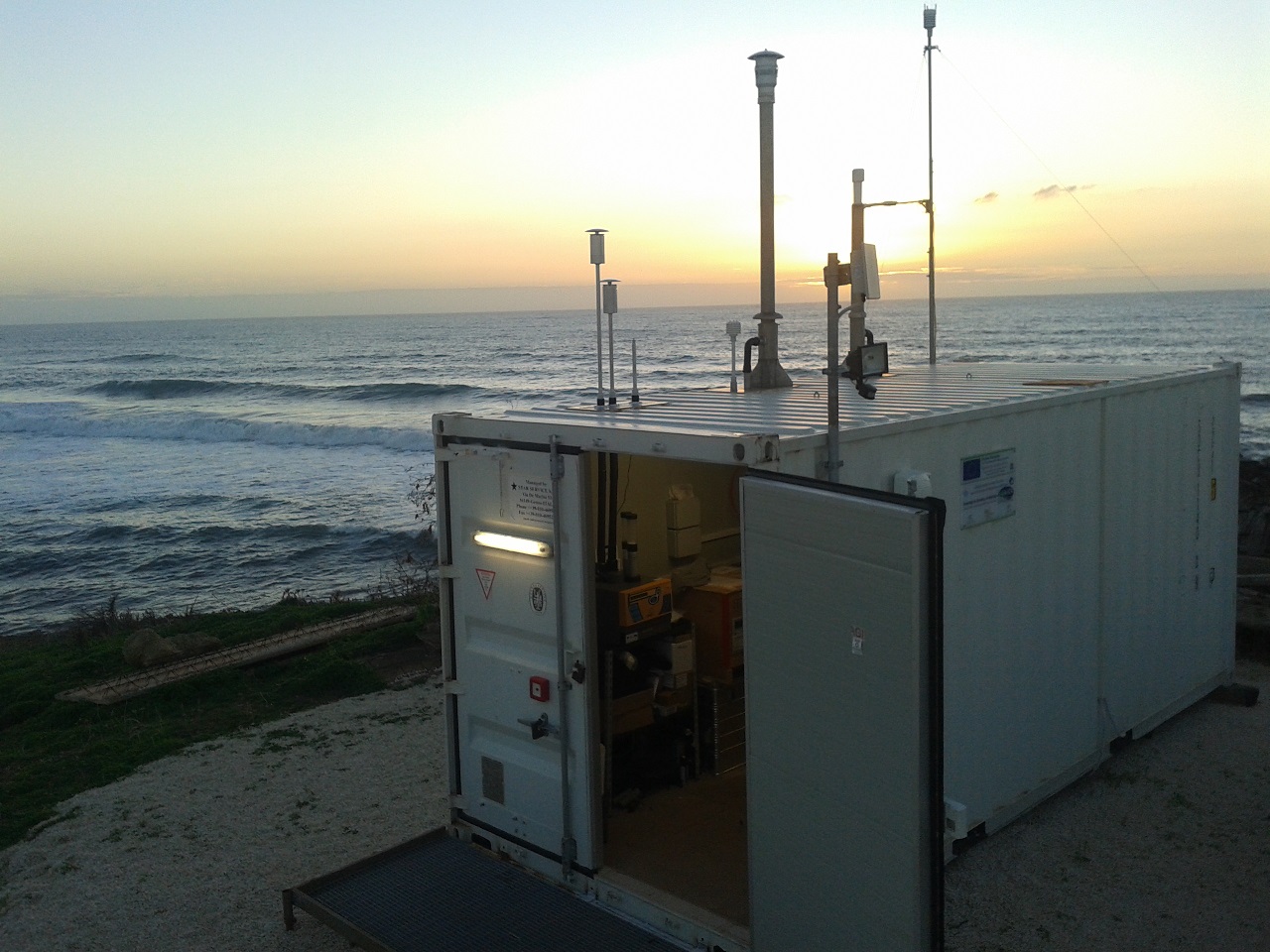
L’Osservatorio Climatico – Ambientale di Capo Granitola si trova nel sito costiero di Torretta Granitola (a 12 km da Mazzara del Vallo ed a 65 km in direzione sud-est rispetto all’Isola di Marettimo), presso la sede CNR -IAMC, dove l’Istituto ISAC ha promosso, in collaborazione con IAMC, le attività di potenziamento infrastrutturale; esso raccoglie in modo continuativo informazioni sulla composizione dell’atmosfera caratteristica della zona costiera della Sicilia occidentale e più in generale del Bacino del Mediterraneo.
L’Osservatorio, posizionato direttamente sulla linea di costa, si affaccia direttamente sul canale di Sicilia e raccoglie informazioni relative al “fondo” atmosferico del bacino del Mediterraneo; al tempo stesso permette di valutare l’influenza che fenomeni specifici (ad esempio: trasporto di masse d’aria a lunga distanza, emissione di aerosol minerale dal Nord Africa, emissione di inquinamento dal traffico navale), possono avere sulla variabilità di composti inquinanti e climalteranti.
In particolare sono stati attivati i seguenti programmi di misura:
- Parametri meteorologici – Bilancio della radiazione solare
- Ozono superficiale – Biossido di zolfo
- Anidride carbonica, metano e monossido di carbonio
- Ossidi d’azoto e
- Distribuzione dimensionale dell’aerosol (particelle da 280 nm a 10 micron di diametro)
- Massa dell’aerosol sulle frazione PM2.5 e PM10
- Massa equivalente del black carbon e coefficiente di assorbimento
- Coefficiente di scattering dell’aerosol a tre lunghezze d’onda
- Conteggio integrato delle particelle di aerosol (a partire da 4μm di diametro)
The Environmental-Climatic Observatory Capo Granitola is located at the Torretta Granitola coastal site (12 km from Mazzara del Vallo and 65 km south-east from Marettimo), within the CNR -IAMC campus. At this Observatory continuous (24/24 and 7/7) atmospheric compoisition measurements are carried out: it is well representative of the western Sicily/central Mediterranean basin conditions.
Capo Granitola I-AMICA ISAC1
The Observatory is located at the coast-line towards the Strait of Sicily: it is able to catch information about the background conditions of the Mediterranean basin, besides providing useful hints to investigate the influence of specific atmospheric processes (e.g., long-rage air-mass transport, mineral dust emitted from northern Africa, anthropogenic ship emissions) on the variability of trace gases and aerosol.
In the framework of I-AMICA, the following measurement programmes have been activated:
- Meteo parameters and solar radiation
- Surface ozone and sulphur dioxide
- Carbon monoxide, carbon dioxide, methane
- Nitrogen oxides (NO and NO2)
- Aerosol number size distribution (particles from 280 nm to 10 micron)
- Aerosol mass (PM2.5 and PM10)
- Equivalent black carbon concentration and aerosol absorption coefficient
- Aerosol scattering coefficient at three wavelenghts
- Integrated aerosol particle counting (for particles with 4μm lowest diameter)
|
|
Citation proposal
(2013) . Capo Granitola (Sicilia). https://geoportal.mountaingenius.org/geonetwork/srv/api/records/7ddba7bb-5968-42d5-b5f4-fdd837dce7b9 |
Simple
- Date ( Publication )
- 2013-05-20T10:26:00
- Edition
- Presentation form
- Digital document
- Purpose
- Status
- On going
Originator
- Maintenance and update frequency
- As needed
- Keywords ( Theme )
-
- I-AMICA
- Keywords ( Place )
-
- Italy
- GEMET - INSPIRE themes, version 1.0 ( Theme )
-
- Atmospheric conditions
- Access constraints
- Copyright
- Other constraints
- Spatial representation type
- Vector
- Metadata language
- eng
- Character set
- UTF8
- Topic category
-
- Boundaries
))
Vertical extent
- Supplemental Information
- You can customize the template to suit your needs. You can add and remove fields and fill out default information (e.g. contact details). Fields you can not change in the default view may be accessible in the more comprehensive (and more complex) advanced view. You can even use the XML editor to create custom structures, but they have to be validated by the system, so know what you do :-)
- Reference system identifier
- WGS 1984
- OnLine resource
-
Site description
Site description
- OnLine resource
-
Real time data
Real time data
- Protocol
- OGC:WMS-1.1.1-http-get-map
- Name
- Description
- Hierarchy level
- Dataset
- Statement
gmd:MD_Metadata
- File identifier
- 7ddba7bb-5968-42d5-b5f4-fdd837dce7b9 XML
- Metadata language
- eng
- Character set
- UTF8
- Parent identifier
- 3b597392-b408-42ab-9034-ec446c6b59ca
- Date stamp
- 2015-05-06T17:08:40
- Metadata standard name
- ISO 19115:2003/19139
- Metadata standard version
- 1.0
Point of contact
Overviews
Provided by
