
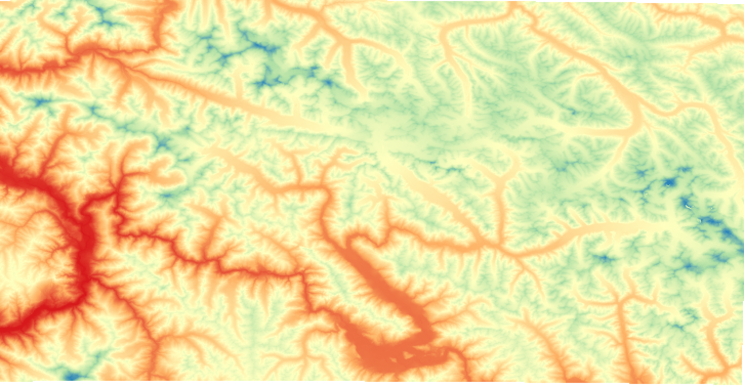
GDEM 2011
In the SEED maps the GDEM with 30 m of resolution was adopted.
|
|
Citation proposal
. GDEM 2011. https://geoportal.mountaingenius.org/geonetwork/srv/api/records/702033ef-9865-4d4d-9d83-e76615eff9eb |
- Identification
- Distribution
- Quality
- Spatial rep.
- Ref. system
- Content
- Portrayal
- Metadata
- Md. constraints
- Md. maintenance
- Schema info
Identification
Data identification
Citation
- Date ( Publication )
- Edition
- Presentation form
- Digital map
- Purpose
- Status
- Completed
Originator
- Maintenance and update frequency
- As needed
- Keywords ( Theme )
-
Legal constraints
- Access constraints
- Copyright
- Other constraints
- Spatial representation type
- Vector
- Metadata language
- eng
- Character set
- UTF8
- Topic category
-
- Boundaries
N
S
E
W
))
- Supplemental Information
- You can customize the template to suit your needs. You can add and remove fields and fill out default information (e.g. contact details). Fields you can not change in the default view may be accessible in the more comprehensive (and more complex) advanced view. You can even use the XML editor to create custom structures, but they have to be validated by the system, so know what you do :-)
Distribution
- OnLine resource
-
GDEM_2011.zip
Download raster data
Quality
Data quality
- Hierarchy level
- Series
- Statement
Ref. system
- Reference system identifier
- WGS 1984
Overviews
Screenshot%202024-04-11%20at%2015.40.05.png
Provided by

Views
702033ef-9865-4d4d-9d83-e76615eff9eb
Access to the portal
Read here the full details and access to the data.
Associated resources
Not available