
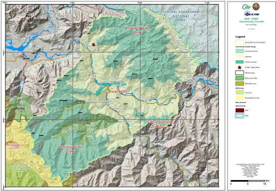
CKNP-DNP Connectivity corridor zoning map
The study of the DNP Management Plan proposed the recognition of a corridor between the DNP and CKNP. In the map, this proposed
|
|
Citation proposal
. CKNP-DNP Connectivity corridor zoning map. https://geoportal.mountaingenius.org/geonetwork/srv/api/records/5aa6842e-6fe8-4c41-b7d7-95aa02e994bf |
Simple
- Date ( Publication )
- Edition
- Purpose
- Status
- Completed
- Maintenance and update frequency
- As needed
- Keywords ( Theme )
-
- Maps , Thematic cartography , Remote sensing
- Keywords ( Place )
-
- Deosai , Pakistan , Baltistan
- Access constraints
- Copyright
- Use constraints
- otherRestictions
- Other constraints
- Spatial representation type
- Vector
- Denominator
- 50000
- Metadata language
- English
- Character set
- UTF8
N
S
E
W
))
- Reference system identifier
- WGS 1984
- OnLine resource
- CKNP-DNP Corridor Zoning Map
- Hierarchy level
- Dataset
- Statement
gmd:MD_Metadata
- File identifier
- 5aa6842e-6fe8-4c41-b7d7-95aa02e994bf XML
- Metadata language
- English
- Character set
- UTF8
- Parent identifier
- 73aba370-0fbf-4217-9fee-e00e9524db67
- Date stamp
- 2026-01-19T17:18:01
- Metadata standard name
- ISO 19115:2003/19139
- Metadata standard version
- 1.0
Point of contact
Overviews
Provided by

Views
5aa6842e-6fe8-4c41-b7d7-95aa02e994bf
Access to the portal
Read here the full details and access to the data.
Associated resources
Not available