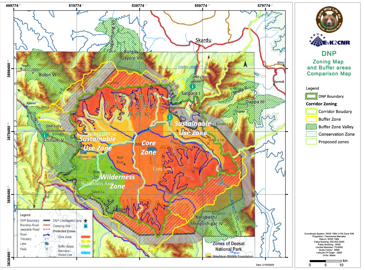
Deosai National Park: Zoning map and buffer areas comparison map
In this Management Plan the boundaries has been delineated with more accuracy and the surface of
the Park is 1621.66, 360.34 Km2 less, but if we include the Buffer Zone and the Buffer Zone Valleys
the total surface is 3000.7 Km2, almost the same of the proposed surface declared in 1993 at the first
declaration of DNP National Park.
The difference between the surface of this map and the surface that is delineated in this plan is mainly
concentrated in the SE side of the Park where it was not designed on the boundary pillars of Bari-La,
but more down in the valleys. The map above is not correct also in the watersheds border especially
on the N side, that delimitate the Deosai plateau and has been corrected on the basis of the GIS data,
the survey of our and DNP staff, starting from the existing pillars. In these differences, there is the
difference in the Core Zone area that is virtually reduced, but it is partially more extended than before
or covered with a strict Buffer Zone.
|
|
Citation proposal
. Deosai National Park: Zoning map and buffer areas comparison map. https://geoportal.mountaingenius.org/geonetwork/srv/api/records/1eee527e-d8a6-4a1d-9d5c-8aad9edd2f10 |
INSPIRE
Identification
- File identifier
- 1eee527e-d8a6-4a1d-9d5c-8aad9edd2f10 XML
Online resource
- Protocol
- WWW:DOWNLOAD-1.0-http--download
Resource identifier
- Metadata language
- English
- Spatial representation type
- Vector
Encoding
Projection
- code
- WGS 1984
Classification of data and services
Classification of data and services
Coupled resource
Coupled resource
Classification of data and services
Coupled resource
Coupled resource
Keywords
Other keywords
- Keywords ( Theme )
-
- Maps , Thematic cartography , Remote sensing
- Keywords ( Place )
-
- Deosai , Pakistan , Baltistan
Geographic coverage
))
Temporal reference
Temporal extent
Temporal extent
- Date ( Publication )
Quality and validity
- Lineage
- Denominator
- 50000
Conformity
Conformity
Conformity
Conformity
Conformity
Conformity
Restrictions on access and use
- Access constraints
Restrictions on access and use
Responsible organization (s)
Contact for the resource
- Organisation name
- University of Cagliari
- titimelis@unica.it
Responsible organization (s)
Contact for the resource
- Organisation name
- University of Cagliari
- titimelis@unica.it
Metadata information
Contact for the metadata
- Organisation name
- University of Cagliari
- titimelis@unica.it
- Date stamp
- 2024-04-12T15:13:48
- Metadata language
- English
- Character set
- UTF8
SDS
Conformance class 1: invocable
Access Point URL
Endpoint URL
Technical specification
Conformance class 2: interoperable
Coordinate reference system
Quality of Service
Access constraints
Limitation
Use constraints
Limitation
Responsible custodian
Contact for the resource
Conformance class 3: harmonized
Overviews
Provided by