
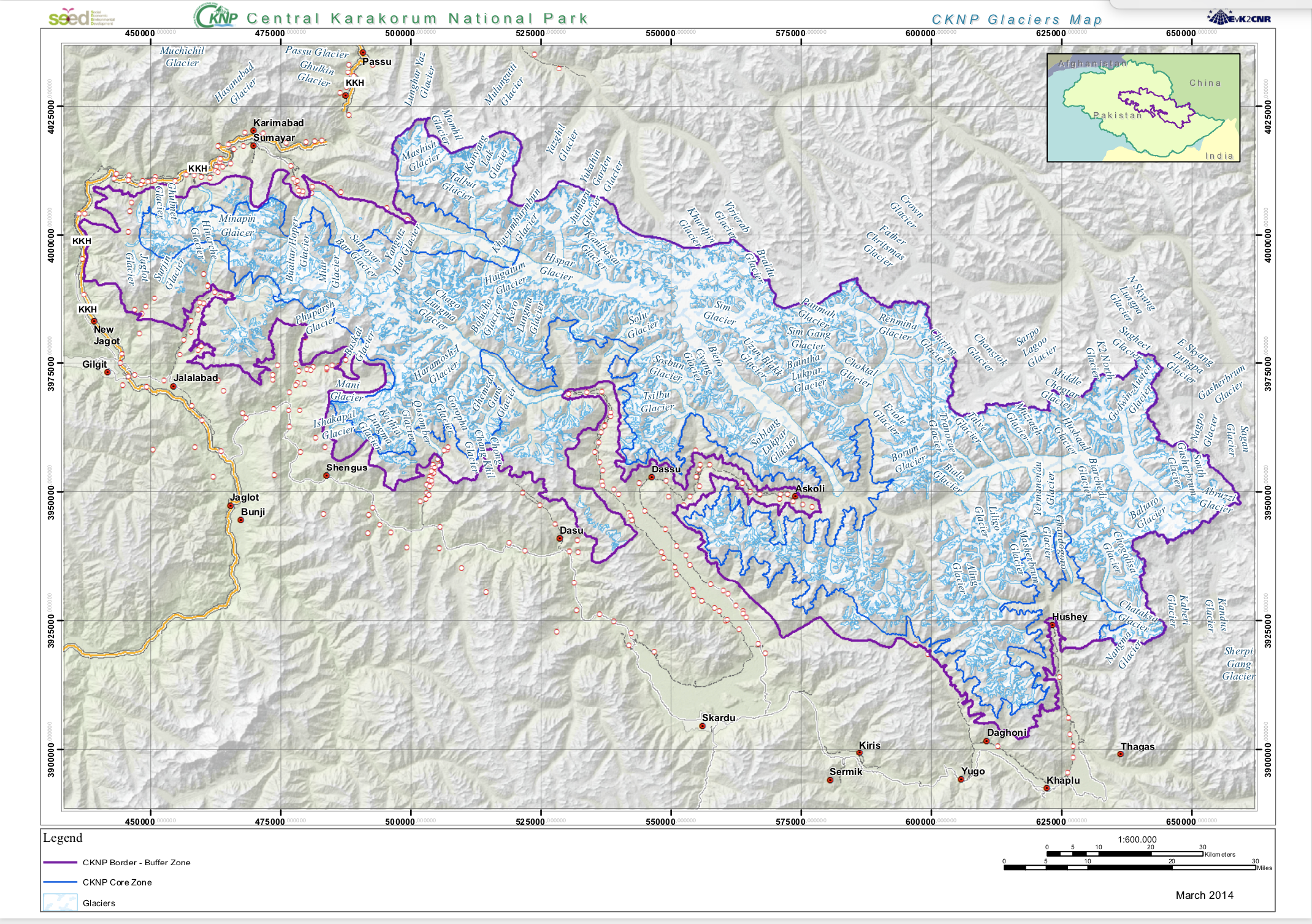
Glaciers Map
The Glaciers from Landsat imagery were mapped from visual interpretation
|
|
Citation proposal
. Glaciers Map. https://geoportal.mountaingenius.org/geonetwork/srv/api/records/0d0c8b5d-1325-4ed1-913f-3181f8875cf7 |
INSPIRE
Identification
- File identifier
- 0d0c8b5d-1325-4ed1-913f-3181f8875cf7 XML
Online resource
- Protocol
- WWW:LINK-1.0-http--link
- Protocol
- WWW:DOWNLOAD-1.0-http--download
- Protocol
- OGC:WMS-1.3.0-http-get-capabilities
Resource identifier
- Metadata language
- eng
- Spatial representation type
- Vector
Encoding
Projection
- code
- WGS 1984
Classification of data and services
- Topic category
-
- Boundaries
Classification of data and services
Coupled resource
Coupled resource
Classification of data and services
Coupled resource
Coupled resource
Keywords
Other keywords
- Keywords ( Theme )
-
Geographic coverage
N
S
E
W
))
Temporal reference
Temporal extent
Temporal extent
- Date ( Publication )
Quality and validity
- Lineage
Conformity
Conformity
Conformity
Conformity
Conformity
Conformity
Restrictions on access and use
- Access constraints
Restrictions on access and use
Responsible organization (s)
Contact for the resource
- Organisation name
- EvK2CNR
Responsible organization (s)
Contact for the resource
- Organisation name
- EvK2CNR
Metadata information
Contact for the metadata
- Organisation name
- Date stamp
- 2024-04-11T15:47:27
- Metadata language
- eng
- Character set
- UTF8
SDS
Conformance class 1: invocable
Access Point URL
Endpoint URL
Technical specification
Conformance class 2: interoperable
Coordinate reference system
Quality of Service
Access constraints
Limitation
Use constraints
Limitation
Responsible custodian
Contact for the resource
Conformance class 3: harmonized
Overviews
Screenshot%202024-04-11%20at%2015.45.12.png
Provided by

Views
0d0c8b5d-1325-4ed1-913f-3181f8875cf7
Access to the portal
Read here the full details and access to the data.
Associated resources
Not available