
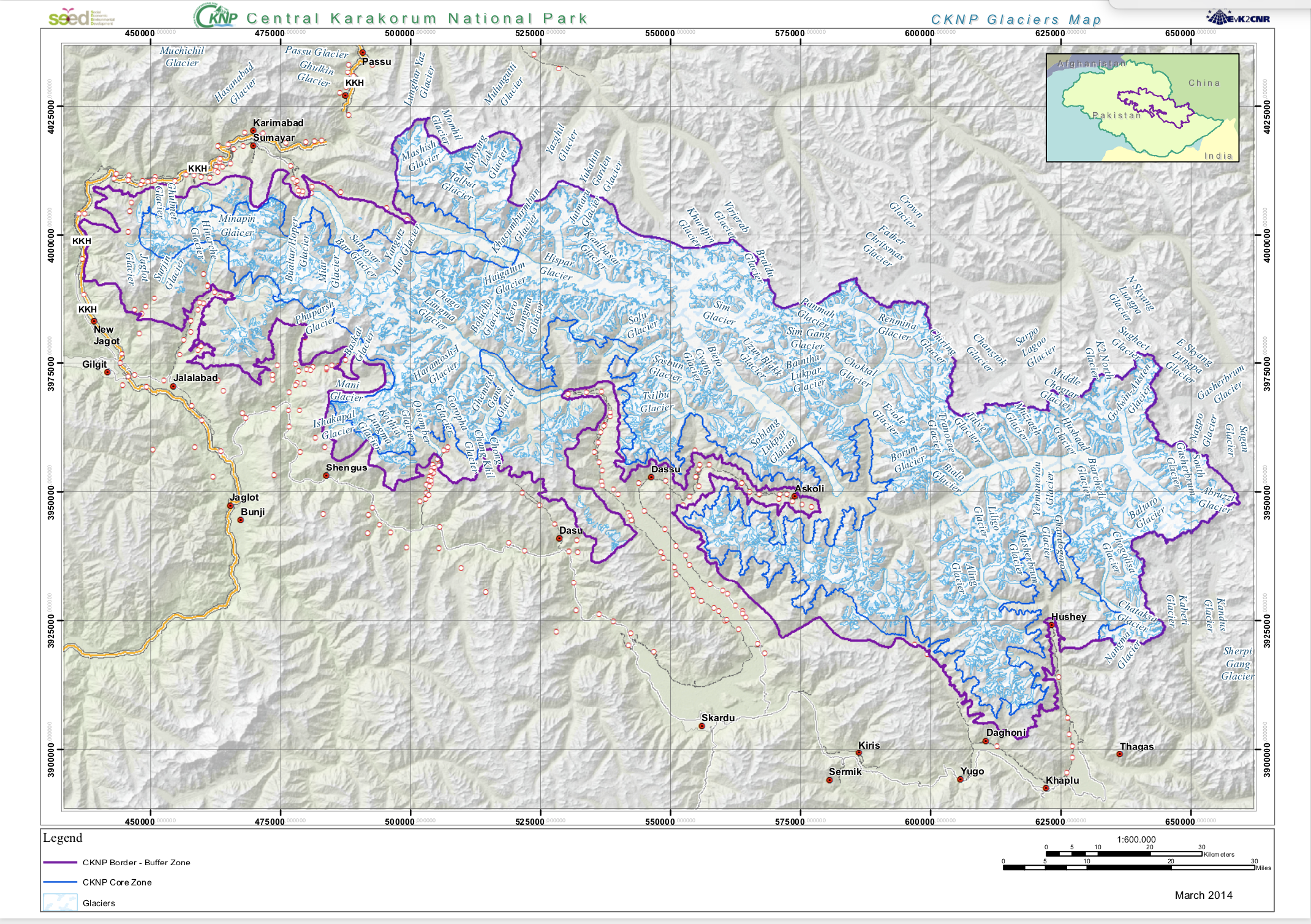
Glaciers Map
The Glaciers from Landsat imagery were mapped from visual interpretation
|
|
Citation proposal
. Glaciers Map. https://geoportal.mountaingenius.org/geonetwork/srv/api/records/0d0c8b5d-1325-4ed1-913f-3181f8875cf7 |
Simple
- Date ( Publication )
- Edition
- Presentation form
- Digital map
- Purpose
- Status
- Completed
Originator
- Maintenance and update frequency
- As needed
- Keywords ( Theme )
-
- Access constraints
- Copyright
- Other constraints
- Spatial representation type
- Vector
- Metadata language
- eng
- Character set
- UTF8
- Topic category
-
- Boundaries
N
S
E
W
))
- Supplemental Information
- You can customize the template to suit your needs. You can add and remove fields and fill out default information (e.g. contact details). Fields you can not change in the default view may be accessible in the more comprehensive (and more complex) advanced view. You can even use the XML editor to create custom structures, but they have to be validated by the system, so know what you do :-)
- Reference system identifier
- WGS 1984
- OnLine resource
- SHARE Geonetwork
- OnLine resource
-
Glacier.zip
Download shapefile
- OnLine resource
-
gbgeo:SEED_GLACIERS
SEED_GLACIERS
- Hierarchy level
- Dataset
- Statement
Overviews
Screenshot%202024-04-11%20at%2015.45.12.png
Provided by

Views
0d0c8b5d-1325-4ed1-913f-3181f8875cf7
Access to the portal
Read here the full details and access to the data.
Associated resources
Not available