
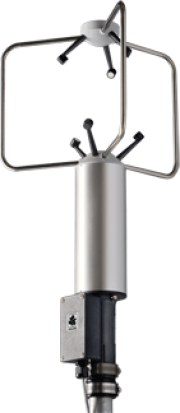
Eboli Borgo Cioffi Young 81000 Anemometer
Young 8100 anemometer technical data:
- Wind Speed: 0 to 40 m/s (0 to 90 mph)
Resolution: 0.01 m/s
Threshold: 0.01 m/s
Accuracy: ±1% ±0.05m/s (30 m/s), ±3% (40 m/s)
- Wind Direction: 0 to 360 degrees
Elevation Range: ±60 degrees
Resolution: 0.1 degree
Accuracy:± 2 degrees (30 m/s), ± 5 degrees (40 m/s)
- Speed of Sound: 300 to 360 m/s
Resolution: 0.01 m/s
Accuracy: ± 0.1% ± 0.05 m/s (30 m/s)
- Sonic Temperature: -50 to +50 ˚C
Resolution: 0.01 m/s
Accuracy: ±2˚C (30 m/s)
- Serial Output: User Programmable ASCII, RS-232 or RS-485 1200 to 38400 baud 4 to 32 Hz (user-selected)
Units: m/s, cm/s, mph, knots, km/h
-Analog Voltage Outputs: 4 voltage outputs, 0 to 5000 mV
- Power Requirement: 12 to 24 VDC, 110 mA
- Operating Temperature: -50 to +50 °C
- Dimensions: 56cm high x 17cm radius (3 support arms)
Weight: 1.2 kg (2.6 lb)
Shipping Weight: 4.5 kg (10 lb)
|
|
Citation proposal
. Eboli Borgo Cioffi Young 81000 Anemometer. https://geoportal.mountaingenius.org/geonetwork/srv/api/records/02e99be9-329e-47c9-a4e6-f4c78229bb64 |
Simple
- Date ( Publication )
- Edition
- Presentation form
- Digital document
- Purpose
- Ultrasonic wind sensor
- Status
- Historical archive
Point of contact
- Maintenance and update frequency
- As needed
- Keywords ( Theme )
-
- SHARE
- Keywords ( Theme )
-
- SHARE
- Keywords ( Theme )
-
- I-AMICA
- Keywords ( Place )
-
- Eboli Borgo Cioffi , Campania , Italy
- Keywords ( Discipline )
-
- agriculture , atmosphere , air , carbon , remote sensing , nitrogen
- Keywords ( Theme )
-
- SHARE
- Keywords ( Theme )
-
- I-AMICA
- Keywords ( Place )
-
- Eboli Borgo Cioffi , Campania , Italy
- Keywords ( Discipline )
-
- agriculture , atmosphere , air , carbon , remote sensing , nitrogen
- Keywords ( Theme )
-
- SHARE
- Keywords ( Theme )
-
- I-AMICA
- Keywords ( Place )
-
- Eboli Borgo Cioffi , Campania , Italy
- Keywords ( Discipline )
-
- agriculture , atmosphere , air , carbon , remote sensing , nitrogen
- Access constraints
- Copyright
- Other constraints
- Spatial representation type
- Vector
- Metadata language
- eng
- Character set
- UTF8
- Topic category
-
- Boundaries
))
Vertical extent
- Supplemental Information
- You can customize the template to suit your needs. You can add and remove fields and fill out default information (e.g. contact details). Fields you can not change in the default view may be accessible in the more comprehensive (and more complex) advanced view. You can even use the XML editor to create custom structures, but they have to be validated by the system, so know what you do :-)
- Reference system identifier
- WGS 1984
- Protocol
- WWW:LINK-1.0-http--link
- Name
- Description
- Protocol
- OGC:WMS-1.1.1-http-get-map
- Name
- Description
- Hierarchy level
- Dataset
- Statement
Overviews

Provided by
